

Waters of the United States
Water stress is becoming one of the most critical challenges as our planet warms. The health of hydrology networks informs flood models, fire susceptibility and drought. Yet, 48% of total surface water in the stream network exists at the dendritic tips (the irregular pattern in which streams branch in all directions and angles) and isn’t monitored.
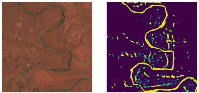
The WOTUS high temporal imagery from space and AI models change the game for hydrology network monitoring, allowing us to now observe how these low-flow streams are changing in real time.
Following initial development during FDL 2020 Trillium worked with USGS to develop a generalizable AI toolset to allow USGS hydrologists to apply Dynamic Hydrology Mapping (DHM) to different parts of the United States. The results of this work will help guide better water management and policy making and ultimately regulation of our shared water assets.